rareoldprints.com
Search
If you know the reference number
enter it here:
If you enter more than one word
it will be treated as
phrase
.
Insert
"and"
or
"or"
between words to search for
the words in any order
.
Refine your search
here or
build another search.
Displaying
0
to
4
of
4
-
-
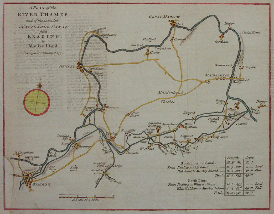
A Plan of the River Thames; and of the Intended Navigable Canal from Reading to Monkey Island, surveyed in 1770 and 1771
Ref:
P/5682
Region:
River Thames
Type: Copper
Date:
1771
Sold
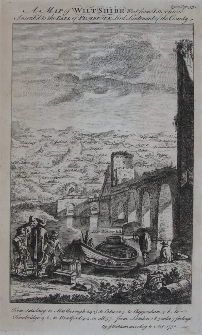
A Map of Wilt Shire West from London
Ref:
P/8005
Region:
Wiltshire
Type: Copper
Cartographer:
Bickham G
Date:
1754
Not for sale
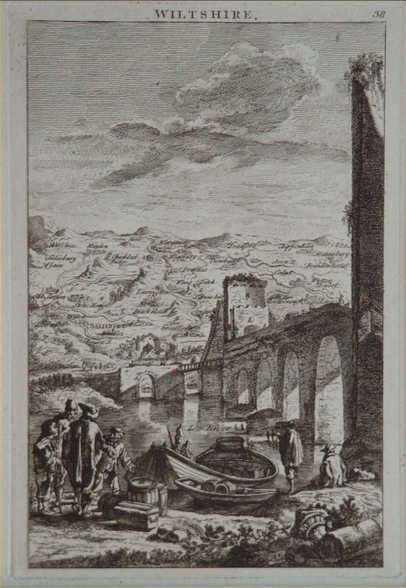
Wiltshire
Ref:
P/8004
Region:
Wiltshire
Type: Copper
Cartographer:
Bickham G
Publisher:
Laurie & Whittle
Date:
1796
Not for sale
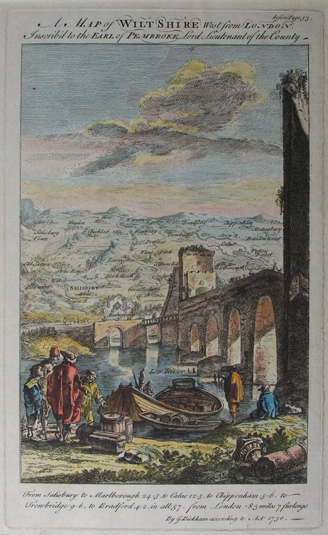
A Map of Wilt Shire West from London
Ref:
P/8169
Region:
Wiltshire
Type: Copper
Date:
1754
Sold
Displaying
0
to
4
of
4